|
| *****SWAAG_ID***** | 877 |
| Date Entered | 05/05/2015 |
| Updated on | 05/05/2015 |
| Recorded by | Ric Carter |
| Category | Geographical Record |
| Record Type | Miscellaneous |
| Site Access | Public Footpath |
| Record Date | 24/04/2015 |
| Location | Moresdale Road |
| Civil Parish | Arkengarthdale |
| Brit. National Grid | |
| Altitude | See below |
| Record Name | Marker/Boundary Stones |
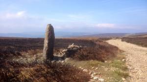
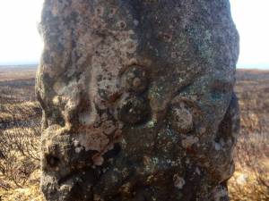
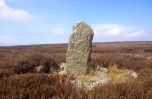
| Record Description | Named on the OS Map as "Stony Man or St Andrew's Cross" this Marker Stone at NZ 03201 Bng. 04014 elev. 469m on the Moresdale road bears the inscribed date 1867 (or it could be 1869 - it is not easy to make out the last digit due to erosion) and stands on what is now the Yorkshire/Durham county boundary. A little way off the road to the North (but also on the present county boundary) stands another Marker Stone (also shown on the OS Map but not named) at NZ02974 Bng.04234 elev.487m similarly dated and bearing the inscribed initials "F M". There are numerous cairns and other features to be explored from the Moresdale Road when time and weather permits, although it is a bit of a trudge across the moor from Hurst, or from the Stang Road if approaching from the opposite direction. For the less intrepid, St. Andrew's Cross can just be made out, in good light, on the far horizon to the South East from the vantage point of the public parking area where the county boundaries are signposted on the Stang Road. |
| Image 1 ID | 6229 Click image to enlarge |
| Image 1 Description | St Andrew's Cross or on the Moresdale Road, West of Hanging Crag |  |
| Image 2 ID | 6230 Click image to enlarge |
| Image 2 Description | St Andrew's Cross (detail) |  |
| Image 3 ID | 6231 Click image to enlarge |
| Image 3 Description | un-named Stone inscribed "F M" |  |


